
This is the excellent company I use:
It is possible to buy USA - NOAA, Department of Defence, CHARTS, as used by the US Navy, for as little as £3.16. each or less if you buy a portfolio.
I used them almost exclusively during my circumnavigation and recommend the 2/3rds size.
I purchased from
who were very helpful and totally reliable.
If you want a c-map system to run electronic 'charts of the world' on a laptop with a gps dongle thus making it into a 'chart plotter' there is a
freeware C-Map type system available at:-
Opencpn is the best chart plotter system on the market - better than anything you pay for and it's free. I confess I do make a 'donation' each year.
You can buy instructions on how to do this together with free copies of the CM93 charts of the world for £15 - it is of course a big download
<a href="ambient.mp3">download
the song (2.6MB mp3)</a>
OpenCPN is free, open source software for marine navigation. The latest stable release of OpenCPN 4.00 is brilliant with plug ins for tide and weather etc
- try searching Google for CM93 free download for charts to use with this system - they appear to be freely available
or
http://www.filestube.com/c/cm93+charts
or
http://www.firstload.com/?uniq=5534f8fbf3380c41&log=47382&fn=cm93+charts
or
Have a look here
http://www.cruisersforum.com/forums/...cpn-74611.html
http://www.vitorrent.cc/torrent/bf3c...032c4048475bcd
also google
https://www.google.co.za/#q=cm93+january+2011
The CPN system is very easy to install.
With it on your laptop or similar, you have a world wide navigation system. Certainly the charts are out of date but the 'hard stuff' does not move - It would be prudent to back up this facility with paper charts and of course you should never rely totally on electronic navigation.
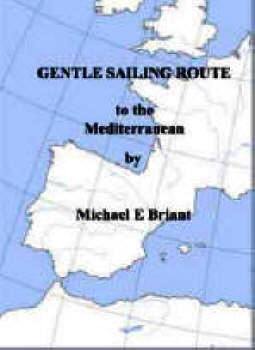
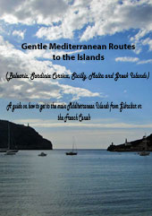
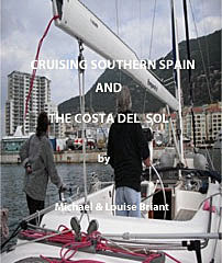
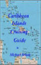
For my sailing books and French canal guides please go to


-------------------------------------------------------------------------------------------------------------------------------------------
Ǻdmiralty
It is very difficult to justify the prices Admiralty Charts charge for their products.
They are able to do this because they 'claim' they, and they alone, own the copyright, almost world wide, to all navigational charts.
The is actually somewhat dishonest and disingenuous.
In the UK, copyright is only protected for 50 years from publication.
The works of Shakespeare, Sheridan and Shaw, Enid Blyton and the Bible are all free to copy, reproduce, sell or use as we please.
What you cannot do is change bits of them, add colour, modernise them, alter the typescript details, then say that the entire work is now your copyright and anybody wanting to copy it, must pay you a fee!
In a few years even Beetles music will be copyright free!
All present day Navigational Marine Charts are based on work that was completed, sometimes hundreds of years ago.
To quote the Admiralty web site:
In 1795, King George III appointed Alexander Dalrymple as the first Hydrographer. The first Admiralty Chart appeared in 1800. The second Hydrographer, Captain Thomas Hurd, 1808-1823. received permission to sell charts to the public, oversaw the production the first chart catalogue. Rear Admiral Sir Francis Beaufort, was appointed in 1829. to expand and improve chart coverage. By the year 1855, the Admiralty Chart Catalogue listed 1,981 charts
Every one of the charts in the 1855 catalogue was out of copyright by 1905! In fact, every chart published in the UK up to 1960, is out of copyright and the information contained in those charts is available to us without copyright fees.
You cannot add ‘colour’ and the position of some buoys and claim it is 'a new work' but this is what the Ǻdmiralty does.
Money is wasted on an extensive web site, staff paid solely to 'protect' copyright and the expansion of an 'empire'. Advertising, extensive colour brochures, stands at boat shows are pointless, because you cannot actually legally buy these products elsewhere. Stamfords etc all pay a substantial copyright fee, in order to be allowed to publish their own editions.
British boat owners are obliged to pay high prices for charts whilst in the USA you can buy the same products at 'normal' commercial rates or make legal copies for a few pence.
Interesting 83.2% of all the merchant ships in the world do NOT use ADMIRALTY CHARTS charts preferring American NOAA US Navy charts. Apparently often a commercial decision.
The 'electronic charts' for our plotters run on software designed by others and the same electronic charts are available in the USA, free of copyright.
BA even claim 'copyright' for the entire Caribbean and much of the world, which is actually nonsense.
I have had correspondence with BA charts, who confirm they use their copyright claims to maintain a monopoly on all charts sold in the UK. They refuse to disclose exactly how much their mark-up is and appear admit their copyright claim is dubious!
The only legal confirmation the Admiralty have to their copyright ownership, is a rather 'Mickey Mouse' judgement in Malta!....Malta?
In the USA, the government accepts that the original work, done to create all their charts, was finished well over 50 years ago, and allows anybody to access charts, in either paper, electronic form or on the internet - Free of Charge!
Visit the US Bellingham Charts company web site http://www.tidesend.com/ and buy a new US Navy version, of any international chart, for as little as £3.16. I have no commercial interest in that company except as a very contented customer.
If you agree that the Admiralty ‘copyright fee’ and monopoly is unfair then write or email the RYA -
and request they begin to campaign for the right to publish charts, without copyright fees, as in all other major countries of the world.
Contact your MP via
http://www.parliament.uk/mps-lords-and-offices/mps/
and request him to ask them why such extortionate and unfair charges are levied on ordinary people with small boats by a department which contributes nothing to the exchequer except to self fund.
If you have contacts in the boating press then please contact them and ask them to publish details of the unfair price fixing by the ADMIRALTY CHARTS.
If you want, point them to this web page, write that you agree and want changes to this unfair and possibly illegal price structure.
![]()
![]()
![]()
![]()
![]()
![]()
![]()
![]()
![]()
![]()
![]()
![]()
![]()
![]()
![]()
![]()
![]()
![]()
![]()
![]()
![]()
![]()
![]()
![]()
![]()
![]()
![]()
![]()
![]()
![]()
![]()
![]()
![]()
![]()
![]()
![]()
![]()
![]()
![]()
For my sailing books and French canal guides please go to
I am pleased to say this web site is

who have been kind, helpful and understanding. I really recommend them