|
Costa del Sol and Gibraltar Boat Jumble
To advertise on this page for 6 months is £5 -
Make a PayPal or
CC payment and send me an email with
details of item and photo to
sales@michaelbriant.com
Your ad will go onto the top of the list
|
Item description |
Photograph |
|
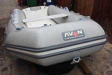
AVON LITE RIB
3.20.
25
| |
|
Beam |
5′1″ (154 cm.) |
|
Length |
10′2″ (310 cm.) |
|
Weight |
94 lbs. (43 kg.) |
|
Passengers |
4 People |
|
Max Horsepower |
10 HP |
|
sold
Originally
purchased in 2009 it comes with
oars, Avon inflator, 3 point lifting strap. The Vhull is GRP |
 |
Lewmar CQR Anchor - 15 KG - 35lb
£35
Drop-forged construction
*Hinged shank for consistent setting and holding
*Lloyd's Register classified as a High Holding
Power (HHP) anchor.sold |
 |
|
Admiralty Pilots
Please note publication dates -
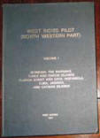
West Indies Pilot Vol 1 north western part -
Bahamas to Caymans 1971 £5
West Indies Pilot Vol 2 Mona Passage to Grenada
1969........................£5
West Coast Spain and Portugual Azores to
Gibraltar & Straits 1972........£5
South Indian Ocean - Madagascar to Seychelles
Reunion 1971..............£5
Africa Pilot vol 1 Azores, Madeira Canaries &
west coast Africa.............£5
Africa Pilot vol 3 Southern and East coasts
1967 ................................£5
Red Sea & Gulf of Aden Pilot
1967..................................................£5
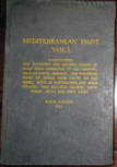
Mediterranean Pilot vol 1 Gib to Scilly
1963.........................................£5
Mediterranean Pilot vol 2 France and
Italy1965....................................£5
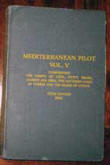
Mediterranean Pilot vol 5 Libya to
Cyprus...........................................£5
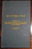
Bay of Biscay Pilot Penmarc'h to Ortegal..1970...................................£5
Bay of Bengal Pilot Ceylon to Nicobar
1966........................................£5
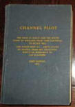
Channel Pilot Scillies to Selsey Bill & French
coast 1971......................£5
Or £55 all the above.....................
Non Admiralty
Friesian Pilot - Mark Brackenbury 1979 - Den
Helder to Kiel Canal............ £5
Deep Sea Sailing - Errol Bruce
1953...........................................................£5
To purchase any or all of the above email:
sales@michaelbriant.com |
 |
|
INTRACOSTAL WATERWAYS
Chart Kits BBA - I purchased them 2nd hand around
1999 and are perfectly usable but covers are tatty. They cover
the ICW plus the adjacent coastal waterways and coastal
entrances and ports.
Florida East Coast and the Keys - Region
7................. £15
The Bahamas - (tatty but
useable)...............................£5
Chesapeak and Delaware Bay Region
4.......................................£15
Norfolk to Jacksonville - Florida....Region 6 (tatty but
useable)... . £5
New
York to Nantucket Region 3 excellent
.................................;£15
Or £50 for the lot
To purchase any or all of the above email:
sales@michaelbriant.com |


 |
|
Panama into Pacific folio
British ~Admiralty charts - Passage Charts
1925 Gulf of Panama - 1984
B&W...........................£10
4062 South Pacific - Eastern Part colour
1994............£10
4061 South Pacific - western part colour
1995.............£10
4607 South East Polynesia colour
1994......................£10
4606 Tonga and Tuamotu Islands colour
1994............£10
4604 Coral and Solomon Seas colour
1995.................£10
4605 New Zealand, Fiji and Samoa colour
1994..........£10
or £60 the 7 above
charts.................................
Tides End - Bellingham
B&W charts
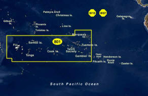
folio 801 South Pacific Islands
you can view the portfolios at:
https://tidesend.com/index.php/chart-portfolios/south-pacific-galapagos-islands
To purchase any or all of the above email:
sales@michaelbriant.com
|
Chart # |
Title |
|
0162 |
Society Islands Moorea, Papetoai and Paopao Bays |
|
1792 |
Marquesas Islands, UA HUKA Island |
|
1797 |
The Marquesas Islands |
|
1805 |
Anchorages in the Marquesas Islands |
|
1808 |
Anchorages inf the Marquesas Islands: A) PUA MAU (Perigot
Bay), B) VIPVHAI (Trators Bay), C) HANA MEW, D) HANA
IAPA, E) VAI TAHU including TAA HUKU |
|
1809 |
Anchorages in the Marquesas Islands: A) HAKA HETAU,
B) VAIEO BAY, C) HUAPU ISLAND |
|
1986 |
Plans in the South Pacific Ocean |
|
1987 |
Anchorages in the Society Islands |
|
1992 |
Society Islands, Tahiti - South Coast, Port Phaeton
& Approaches |
|
2004 |
Islands and Anchorages in the Tuamotu Archipelago |
|
2006 |
Tonga Islands - Momuka Group |
|
2007 |
Tonga Islands - Ha’apai Group (Northern Part) |
|
2008B |
Marshall Islands, Majuro Atoll |
|
2009 |
Tonga or Friendly Islands, HA'APAI GROUP, LIFUKA
ISLAND Anchorage and Approaches |
|
2010 |
Marshall Islands, Wast Central Part of ENIWETOK
ATOLL |
|
2011 |
Rapa Island |
|
2013 |
Tonga Islands, Tongatabu Island, Approches to
NUKUALOFA Anchorage |
|
2024 |
Tuamotu Archipelago, Plans: a.) the pass and
anchorage of Rarioa Island, b.) Mangareva or Gambier
Islands |
|
2025 |
North Coast of Tahiti, Papeete Pass to Papenu Pass |
|
2080 |
Port RIKITEA Gambier Islands, Mangareva Island-
Tuamotu Archilpelago |
|
2149 |
Southwest Coat of Tahiti;, Rautirare Pass to Maraa
Pass |
|
2228 |
Illes Tubuai (Austral Islands), Ile Raivavae (Vavitu) |
|
2363 |
Tonga, Approaches to NUKU'ALOFA |
|
2850 |
FIJI ISLANDS |
|
2851 |
FIJI ISLANDS, Eastern Archipelago, (Northern
Portion) |
|
2859 |
FIJI ISLANDS, East Coast of Viti Levu and the
Adjacent Islands to the Eastward (also 83584) |
|
2865 |
FIJI ISLANDS, SUVA HARBOR |
|
5900 |
Tongatabu Island - Tonga Islands, EGERIA Channel |
|
634 |
Isle Tuamotu |
|
78 |
Tuamotu Archipelago-Disappointment Group, A) Tepoto
(Otooho) and Napuka (Wytoohee), B. Pukaruha (Serle
Island), C. Reao (Clermont-Tonnere) |
|
81 |
Tuamotu Archipelago, Plans: A) KING GEORGES GROUP,
B) TAKAPOTO TAKARUA |
|
82 |
Tuamotu Archipelago, Plans: A) AHE and MANIHI
Islands (or Peacock and Wilson Island) |
|
83 |
Plans in The Tuamotu Archipelago: A) PUKAPUKA IS.,
B) MAKATEA, C) TAUERE, D) MAROKAU & RAVAHERE, E)
TAKUME |
|
XXX1 |
Fiji Islands Northwest Part, Vatu Ira Channel with
Adjacent Coasts |
|
2008 |
Tonga Islands, HA'APAI GROUP (Southern Portion) |
|
83597 |
FIJI ISLANDS, Northern Part, VANUA LEVU |
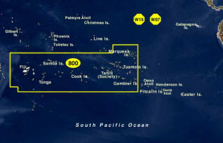
Folio 800
South Pacific Islands
|
Chart # |
Title |
|
83020 |
IIes Marquises Islands (South Pacific Ocean) |
|
83021 |
Manuae to Tahiti (Omega) |
|
83022 |
Makemo to Tatakoto (Omega) |
|
83023 |
Tahiti to Rangiroa and Makemo (Omega) |
|
83024 |
Hao to Fangataufa (Omega) |
|
83025 |
Illes Tuamoto to Iles Gambier (Omega) |
|
83026 |
Samoa Islands (Omega) |
|
83034 |
Fiji - Iles de Horne (Omega) |
|
83039 |
Fiji Islands to Samoa Islands (Omega) |
|
83207 |
Nuku Hiva (Illes Marquises) |
|
83218 |
Hiva Oa, Tahuata & Motane |
|
83251 |
Archipel Des Tuamotu Iles Gambier |
|
83252 |
Ile Mangareva (Iles Gambier) |
|
83253 |
Iles Gambier - Southern Part |
|
83254 |
Rade de Rikitea |
|
83255 |
Muraroa to Fangataufa |
|
83382 |
Approaches toTahiti and Moorea including Maiao and
Tetiaroa - Society Islands |
|
83383 |
Moorea |
|
83385 |
Port of Papeete |
|
83392 |
Iles Sous le Vent - Society Islands, Plans: Manuae,
Mauphiaa, & Motu One |
|
83397 |
Bora-Bora, Plan: Passe Teavanui |
|
83425 |
Islands & Anchorages in the Cook Islands, Plans: A.
Aitutaki, B. Mangaia, C. Takutea, D. Aruntunga
Anchorage (Aitutaki Atoll), E. Rarotonga, F. Manuae
Atoll, G. Atiu, H. Avarua and Avatiu Harbors (Rarotonga),
J. Mauke |
|
83473 |
Savai’i and Upolu (Western Samoa) |
|
83476 |
Harbors of Upolu, Plans: A. Apia Harbor, B. Vailele
Bay, C. Falealili Harbor, D. Aleipata Road |
|
83484 |
U.S. Possessions in Samoa Islands, Plans: Manua
Islands, Pago Pago Harbor, Tutuila Island, Rose
Atoll, Tutuila Island, & Swains Island |
|
83495 |
Isles Wallis, (South Pacific Ocean) (Iles Wallis-Lleuvea)Plans:
Mouillages de Mua And Mata-Uta, Passe Honikulu
NOTE:Chart Error - Correct coordinates for the Passe
Honikulu are:South 13deg 23.5 min,West 176deg 13.0
min |
|
83500 |
Fiji to Tonga Islands (Omega) |
|
83555 |
Vava’u Group (Tonga Islands) |
|
83560 |
Tonga Islands |
|
83563 |
Plans of the Tonga Islands, Plan: Nomuka Harbor |
|
83567 |
Nukualofa and Approaches, Plan: Nukualofa |
|
83570 |
Fiji Islands - Western Part |
|
83572 |
Suva and Approaches, Plan: Suva Harbor |
|
83574 |
Approaches to Lautoka and Vatia Wharf, Plans:
A.Lautoka, B. Vatia Wharf |
|
83580 |
Fiji Islands - Southeastern Part, Plan: Ono-i-Iau |
|
83590 |
Fiji Islands - Northeast Part |
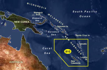
Folio 810
South Pacific Islands
New Caladonia to Vanatau
|
Chart # |
Title |
|
82025 |
Vanuatu (Omega) |
|
82030 |
New Caledonia to Fiji & Vanuatu (New Hebrides)
(Omega) |
|
82527 |
Plans in the Torres & Banks Islands: A. Torres
Islands, B. Hayter Bay (Tequa Island), C. Picot Bay
(Hiw Island), D. Vi Paka Anchorage (Loh Island), E.
Dives Bay (Norbarbar), F. Port Patteson (Vanua Lava
Island) |
|
82534 |
Banks Islands, Plans: A. Lakona Bay (Santa Maria
Island), B. Milli Bay (Saddle Island), C. Avreas Bay
(Vanua Lava Island), D. Loso Lava Anchorage (Santa
Maria Island), E. Masevonu Anchorage (Santa Maria
Island) |
|
82540 |
Torres Islands to Pentecote (Pentecost) |
|
82543 |
Espiritu Santo, Plan: Baie de la Tortue and
Palikoulo Bay |
|
82560 |
Malakula Island to Efate Island (Omega) |
|
82564 |
Ile Malo to Efate |
|
82571 |
Efate Island, Plan: Port-Vila |
|
82580 |
Erromango Island to Anatom |
|
82587 |
Plans in the New Herbrides & Adjacent Islands: A.
Baie D'Anelgaohat, B. Ile Walpole, C. Ile Fortuna,
D. Ile Matthew, E. Ile Hunter, F. Conway Reef, G.
Ile Aneytioum |
|
82646 |
Koumac to Poum to West Coast of New Caledonia |
|
82649 |
Illes Belep to Port de Mueo |
|
82683 |
Nouvelle-Caledonia-Southern Part Including Ile Des
Pins (Omega) |
|
82684 |
Nouvelle-Caledonia (Southeast Part) (Omega) |
|
82689 |
Approaches to Noumes |
|
82690 |
Noumea |
|
82694 |
Mont Dore to Port-Boise |
|
82697 |
Ile Queen to Ile Des Pins Including Passe De La
Sarcelle |
|
82020 |
Solomon Islands to Vanuatu (New Hebrides) (Omega) |
All 3 portfolios in 2/3 size quality copies of US
charts - these are detailed charts of area both portfolios......
£140
you can view the portfolios at
https://tidesend.com/index.php/chart-portfolios/south-pacific-galapagos-islands
To purchase any or all of the above email:
sales@michaelbriant.com |
 |
|
British ~Admiralty charts - Passage Chart
4602 Taslman & Coral Seas - New Caladonia colour
1993..................................£10
Tides End - Bellingham
B&W charts
folio 705
East & Northeast Australia - including the Great Barrier Reef -
63 Charts
|
Chart # |
Title |
|
74000 |
Cape Byron to Port Jackson |
|
74002 |
Cumberland Islands to Fraser Island (Australia-East
Coast) |
|
74003 |
Cape Byron to Lady Elliott Island |
|
74004 |
Frederic Reefs to Cooktown (Australia-East Coast) |
|
74005 |
Cape York Peninsula to Gulf of Papua
(Australia-Indonesia-Papua New Guinea) |
|
74041 |
Reefs & Anchorages in the Coral Sea, Plans: A. Kenn
Reefs, B. West Islet Anchorages, C. Bird Islet
Anchorage, D. Cato Island Reef and Bank, E. Iles
Chesterfield, F. Ile Longue Anchorage, G. Middle
Bellona Reefs, H. South Bellona Reefs |
|
74042 |
Australia-East Coast-Reefs and Anchorages in the
Coral Sea. Plans: A.Lihou Reef, B.Marion Reef,
C.Saumarez Reefs, D.Frederick Reefs, E. Mellish
Reef. |
|
74071 |
Islets & Reefs in the Coral Sea. Plans: A. Holmes
Reef, B. Coringa Islets, C. Flinders & Adj. Reefs |
|
74141 |
Plans in SW Pacific Ocean-Lord Howe Island & Ball's
Pyramid Plans: A. Lord Howe Island & Adjacent Islets
& Reefs, B. Middleton Reef, C. Elizabeth Reef |
|
74151 |
Port Jackson to Port Stephens |
|
74152 |
Newcastle Harbor (Australia-East Coast) |
|
74153 |
Approaches to Newcastle |
|
74161 |
Tacking Point to Port Stephens Plans: A. Crowdy Head
& Anchorage, B. Sugarloaf Anchorage & Adjacent
Dangers |
|
74162 |
Coffs Harbour to Tacking Point |
|
74171 |
Evans Head to Coffs Harbour |
|
74172 |
Evans Head to Danger Point |
|
74181 |
Point Danger to Cape Moreton |
|
74182 |
Moreton Bay Plan: Manly Harbor |
|
74183 |
Brisbane River-The Bar to Lytton Cutting (cancelled
chart, provided as a supplement) |
|
74184 |
Approaches to Moreton Bay, Plan: Mooloolaba Harbour |
|
74186 |
Bisbane River-Lytton Cutting to Victoria Bridge,
Plans: A. Bulimba Reach, B. South Bisbane Reach, C.
Town Reach & Shafston Reach, D. Hamilton Reach |
|
74190 |
Sandy Cape to Moreton Bay |
|
74191 |
Port Bundaberg -Burnett River, Plan: Port Bundaberg |
|
74192 |
Sandy Cape to Bustard Head |
|
74200 |
Great Keppel Island to Sandy Cape |
|
74201 |
Approaches to Port of Gladstone |
|
74202 |
Keppel Bay, Plans: A. Approaches to Port Alma, B.
Port Alma |
|
74204 |
Bustard Head to North Reef, Plan: Continuation of
Fitzroy River |
|
74205 |
Port of Gladstone |
|
74206 |
Plans in Port of Gladstone, Plans: A. Entrance to
North Channel, B. Fishermans Landing Wharf, C.
Clinton Coal Loader Wharf, D. Auckland Point to
Barney Point, E. South Trees Point |
|
74210 |
North Reef to Pine Peak Island |
|
74220 |
Whitsunday Island to Pine Peak Island |
|
74221 |
Hydrographers Passage |
|
74229 |
Hay Point to Penrith Island, Plan: Hay Point |
|
74230 |
Whitsunday Island to Magnetic Island |
|
74231 |
Plans of Mackay & Bowen Plans: Approaches to Port of
Mackay, Mackay Outer Harbour, Approaches to Port of
Bowen, Bowen |
|
74232 |
Cleveland Bay and Approaches |
|
74234 |
Townsville Harbour and Ross River Entrance |
|
74253 |
Russell Island to Low Islets. Plan: Port Douglas |
|
74261 |
Low Islets to Cape Flattery. Plan: Port of Cooktown |
|
74265 |
Frankland Islands to Lizard Island |
|
74270 |
Lizard Island to Cape Sidmouth |
|
74271 |
Barrow Point to Claremont Isles (East Coast), Plans:
Cape Melville & Pipon Islets, & Flinders Group |
|
74272 |
Claremont Isles to Cape Weymouth. Plan: Approaches
to Heath Reef |
|
74273 |
Cape Flattery to Barrow Point, Plan: Howick Group |
|
74281 |
Cape Weymouth to Cairncross Islets |
|
74283 |
Cape Weymouth to Olinda Entrance |
|
74285 |
Bligh Entrance to Eastern Fields |
|
74286 |
Approaches to Thursday Island |
|
74287 |
Gannet and Varzin Passages (Australia - North Coast
- Torres Str |
2/3 size quality copies of US charts - plus
many b&w quality photocopies of UK and Australian charts
covering Sydney to Torres Straight then onto Darwin and East
Timor £70
you can view the portfolio at
https://tidesend.com/index.php/chart-portfolios/south-pacific-galapagos-islandsTo
purchase any or all of the above email:
sales@michaelbriant.com |
 |
|
Timor to Singapore
2/3 size quality copies of US/UK & Australian
charts - quality b&W photo copies
27 plus charts
£30
To purchase any or all of the above email:
sales@michaelbriant.com
|
|
|
Phuket to Suez and to
Cape town
2/3 size quality copies of US/UK - quality
b&W photo copies
about 45 charts
£50
To purchase any or all of the above email:
sales@michaelbriant.com |
|
|
The total value of all the above charts is
£360 - This excludes ICW chart books and the Pilot books.
You can have them
all for £300 plus carriage - if you need a courier
or collect Gibraltar.
To purchase any or all of the above email:
sales@michaelbriant.com |
|
|
|
|
|
THE PACIFIC CROSSING GUIDE
from
the Caribbean and Panama to Australia and New Zealand and the
islands of the South Pacific
Just published on Amazon and
gentlecruising.com
If you are bored with the Mediterranean and the
Caribbean, read this book, then you will want to dream of
visiting the nearest place to paradise on this globe.
How to transit the Panama Canal see giant rays on
the way to the Galapagos and the best islands in the Marquesas
and Touamotu groups before reaching Tahiti the Cook Islands,
Tonga and Fiji then laying up for the hurricane season in New
Zealand or Australia.
Available from
gentlesailing.com
|
 |
|
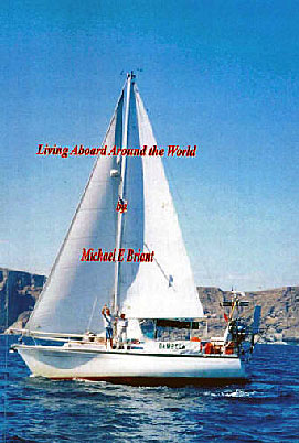
LIVING ABOARD AROUND THE WORLD
If you are thinking about going long distance
cruising then this is the book for you!

CHAPTERS:
1Which Boat and what equipment?
2. The
canal route to the sun.
3. The
sea route to the sun.
4. Cruising
the Mediterranean
5. Crossing
the Atlantic
6. Cruising
the Caribbean.
7. Panama
and Pan Pan
8. The
Canal and into the Pacific
9. South Pacific
Islands
10. Tahiti
to New Zealand
11. Helicopter
Rescue
12. The
Great Barrier Reef
13. Pirate
Attack
14. Tragedy
in the Red Sea.
15. Homeward
Bound
Download now from
http://www.gentlesailing.com/ |
 |
|
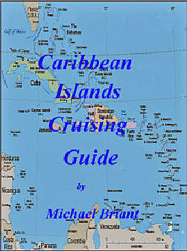
The Caribbean is
probably the biggest and best cruising ground in the world.
Wonderful climate, beautiful islands, nice people and for the
most part very inexpensive. With predictable weather and such
good sailing winds it makes the Mediterranean look like a very
poor relation.
How to get there - how to get home- details of
all the Island groups and anchorages.
Pictures and chart details together with
descriptions of the islands.
Pictures, charts, distances, links to marina's
and faculties, weather and places to visit and what to
see.......
There are two versions the first is for boats
coming from Europe and the second is an American Version for
boats heading south through the Bahamas & Turks and Caicos.
To download this ebook visit
Gentlesailing . Caribbean Islands
or
Amazon Kindle
|
 |
|
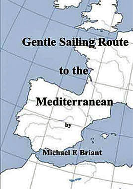
Why not take your boat to the Mediterranean
next summer?
GENTLE SAILING ROUTE
TO THE
MEDITERRANEAN
There are several ways of getting your boat to the
Mediterranean. On the back of a lorry, via the French canals,
four or five day’s non stop across the Bay of Biscay then down
the Portuguese coast or spend the summer or two, gently coasting
southwards, enjoying the harbours, cities, towns and villages of
France Spain and Portugal.
This is not a pilot book, rather a passage plan and guide to the
nicer places between the South Coast of the UK to the beautiful
Mediterranean Sea. It can all be done in easy stages, to suit a
lightly crewed boat, with perhaps only a couple of people on
board who are without ‘offshore’ experience. Actually, it is a
lovely way to explore a lot of delightful foreign places.
More Here
The E-book version is available now £5.00
Download now from
http://www.gentlesailing.com/
|
 |
                                      
French Canal Routes to the Mediterranean 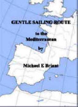  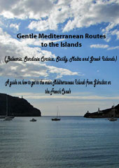
Gentle Sailing Route to the Mediterranean
Gentle Mediterranean Routes to the Islands
The Pacific Crossing Guide
Caribbean Islands Cruising Guides 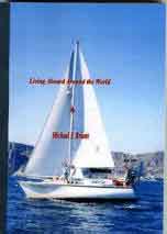 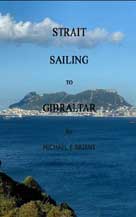 
Strait Sailing to Gibraltar
Living Aboard Around the World
Easy Navigation
For my
sailing books and French canal guides please go to
gentlesailing.com
I am pleased to say this web site is

who have been kind, helpful and understanding.
I really recommend them
Click here to purchase web hosting with HOST 100
|


